Hiking St James Walkway
South Island New Zealand
Lewis Pass South Island New Zealand
Lewis Pass is the Trail head for St James Walkway

Hiking St James Walkway
South Island New Zealand is a 4-5 day hike with huts.
It is an easy, off the beaten track hike that follows beautiful river valleys in a sub-alpine environment.
The track is 40 miles long.
Access is from Lewis Pass Picnic Area on Hwy 7 and ends just 18 miles down Lewis Pass at Boyle Village which makes for a very easy shuttle.
The track and huts are maintained by DOC. A visit to DOC website will explain all the rules, regulations and recommendations for hiking St James Walkway.
This is not a New Zealand “Great Walk“ It is an incredible hike through lovely alpine environment and you do not need to plan a year in advance to “get a spot”
We were bicycling New Zealand. We rode over Lewis Pass and decided to hike. It was that easy!

The DOC website suggests a daily itinerary and gives the mileages between the huts.
There are signposts and cairns. A map is not really necessary.
We followed their suggestions and hiked 5 days with 4 nights at the huts.
We were the only hikers at the huts. Still, we carried our tent and equipment just in case they were busy.
Day 1
We got a late start from the Lewis Pass Picnic Area and decided to hike to the first hut on the route.
It was 4 miles to Cannibal Gorge Hut.
Almost the entire distance was through Beech forest.
We had glimpses of the Mauria River, a rocky alpine creek tumbling down near the trail.
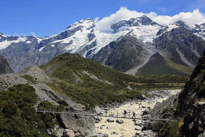
After crossing a suspension bridge over the Mauria river, we hiked uphill the rest of the way to Cannibal Hut


By the time we reached Cannibal Hut, the sun was dipping behind the steep, narrow valley.
There was firewood. We were the only trekkers to use the hut that night.


Day 2
From Cannibal Gorge Hut, we continue uphill over Ada Pass and the hut of the same name. We are still in Beech forest following the Mauria River. There are a few open meadows as well.
We don’t stop at Ada Pass Hut as we have hiked less than 2 miles. Once we cross Ada Pass, we will follow the Ada River. The Beech forest now gives way to lovely meadows surrounded by peaks.
It’s all downhill from Ada Pass to Christopher Hut.
The Ada River is a gem! A favorite!
To reach Christopher Hut from Cannibal Hut, we will have hiked almost 8 miles.


Day 3
We continue hiking downhill after Christopher Hut to the confluence of the Ada and Waiau Rivers.
The Waiau is broad and braided. It rises out of the Spencer Mountains near Lewis Pass and flows to the Pacific. It is a favorite for trout fishing.
We can see a 4-wheel drive access road on the far side.
We only follow the Waiau a short distance before turning inland again to hike up towards the pretty Henry River.

From Christopher Hut to Anne Hut, we have hiked about 6 hours (9 miles). We like to take a lot of photographs. We also spread out in the grass and enjoy the warmth of the afternoon.


Day 4
Anne Hut that we stayed in, pictured in the background of this photo, burned down in 2010.
There is now a new Anne Hut, but in a different location.
Anne Hut to Boyle Flat is about 9 miles.
The biggest climb of the entire route separates us from our destination.
We ascend almost 2500 feet to Anne Saddle.
It is much steeper going down the other side to Boyle Flat and the Boyle River.


Day 5
From Boyle Flat Hut, it is still almost 9 miles to Boyle Village and the end of the trek.
There are no amenities at Boyle Village. The name is a misnomer.
There is still some pretty meadows to hike through, but as the trail continues descending, it enters Beech forest, much like the beginning of the trail and views are limited.
If looking for an easy to moderate hiking trek for 4 or 5 days, with inexpensive hut accommodation, hiking St James Walkway cannot be beat. No long term preparation is necessary. Just be mindful that weather is always a factor in alpine New Zealand and to be prepared for all conditions… and enjoy hiking St James Walkway. It’s like a “Great Walk” without all the people!


Hiking Tongariro National Park New Zealand
Hiking Mt Cook National Park New Zealand
Anne Hut to Boyle Flat
Copyright Material
All rights reserved. No part of this page may be reproduced or utilized in any form by any means, electronic or mechanical, including downloading, print screen, photocopying, recording, or by any information storage or retrieval system, without the prior written permission by the copyright owner.